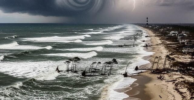
While the national news focuses on the Category 4 winds of Hurricane Erin, residents of Hatteras Island know that the most significant threat often comes not from the air, but from the sea. The sheer size of this “monster” storm is generating immense swells that are expected to batter the Outer Banks coastline, leading to severe ocean overwash and beach erosion. This phenomenon occurs when powerful waves and a rising storm surge push water completely over the narrow barrier island, depositing sand and debris onto the main roadways and into homes. This is the primary reason why NC Highway 12, the only road connecting the island to the mainland, is anticipated to be impassable for days, a direct result of the water’s destructive power, not the wind’s. The National Oceanic and Atmospheric Administration (NOAA) has been tracking this threat with great precision, using sophisticated models to predict the height of the storm surge and the potential for inundation, allowing Dare County officials to make the difficult but necessary decision to issue a mandatory evacuation.
The science of hurricane forecasting has become a critical tool in modern disaster preparedness. The various “spaghetti models,” while sometimes confusing to the public, provide forecasters with a range of possible scenarios for a storm’s track and intensity. By analyzing these models, experts can identify the most likely outcomes and communicate the potential risks to the public. For Hurricane Erin, these models have consistently shown a track that spares the U.S. East Coast a direct hit from the eye but still brings life-threatening conditions due to the storm’s expansive size. The ability to forecast this type of distant but dangerous scenario is a testament to the advancements in meteorological technology and the collaboration between agencies like NOAA and the National Hurricane Center (NHC). For communities like Hatteras Island, these forecasts are more than just numbers; they are the basis for life-saving evacuation orders and the foundation of a community’s emergency response plan. Understanding the difference between a direct hit and a high-impact distant storm is crucial for public safety and shows the power of modern forecasting to mitigate loss of life and property. The key is knowing that the threat is not always about the eye of the storm. It’s about the reach of its arms.

